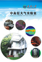
This Geophysics station is approved by the Ministry of Science and Technology of China. It is the only National Geophysical Field Station directly under the Ministry of Education. And it has become an important atmospheric environmental monitoring research base, and developed into a lidar research and development center and related personnel training center. It is committing to the development of new lidar and other ground-based and space-based high-precision optical remote sensing equipment, providing reliable detection methods for the National Space Environment Support System.
Combining theory with experiment, the field station conducts research on the middle and upper atmosphere. While studying atmospheric theory and making routine observations on the middle and upper atmosphere, the station focuses on researching and developing lidar and other middle and upper atmosphere remote sensing and detection devices. In May, 2010, the team at Wuhan University was evaluated and found to have excellent performance by an MOE expert panel headed by academician Luo Jun. The space physics team of young teachers led by academician Luo Jun had a project of innovation research group, “middle-and upper-atmosphere remote sensing detection and numerical modeling“, approved by the National Natural Science Foundation Committee in 2012, and had the special project to develop key national scientific research equipment, “advanced lidar that can rapidly and precisely measure atmospheric temperature and aerosols between 0-35km”, approved by the National Natural Science Foundation Committee in 2013.
Through over 10 years’ efforts, the field station has built a platform for the comprehensive detection of middle-and upper atmosphere lidar. Functioning the best in Asia, the platform was listed one of the top 10 technological progresses in 2011 by the Science & Technology Review. The field station has become a globally influential station for observing metal layers. The team has developed large radars of the most precise detection (the largest porosity and best power performance) in today’s world and these large radars include iron resonance fluorescence lidar, iron Boltzmann lidar, and six-channel Raman/Mie/Rayleigh polarization lidar; it succeeds in precisely and simultaneously observing the iron, sodium, and calcium atoms in covolume in the mesopause between 80-100km, and it has discovered a new and universal observation, which has changed people’s views on the metal layer of mesopause; it succeeds in measuring the atmospheric temperature profile between ground level and 100km altitude through simultaneous remote sensing.This enables lidar to detect atmospheric aerosols, water vapor, clouds, and other parameters. The station has developed a 532nm pure rotational Raman lidar that can rapidly and accurately measure atmospheric temperature, which ranks fifth in terms of measurement capability among the world’s existing 16 lidars of its kind; it has discovered that water vapor Raman spectra remain constant under cleary sky through observation by using the world’s second atmospheric water vapor Raman lidar it has developed independently, and it has for the first time obtained the Raman spectra of atmospheric liquid water layer.
The team has developed non-linear numerical models of middle and upper atmospheric oscillations for observing the middle and upper atmospheric structure and disturbances as well as for numerical investigation. The station has taken the lead in studying the interaction between the non-linear resonance and off-resonance of atmospheric gravity waves, relevant research achievements have been well recognized by peers worldwide, and relevant researchers were granted with the Basu Early Career Award in Sun-Earth Systems Science by the American Geophysical Union in 2010. By combining the analysis of routinely observed data and numerical modeling, the team has conducted comprehensive and in-depth research on atmospheric gravity waves, tides, and planetary scales, and has a number of research papers published in core international journals, becoming an important team of researchers in atmospheric oscillation in the world.
Since 1999, the station has continuously undertaken the sub research projects and key research projects of National Natural Science Foundation as well as the projects of both MOE’s major training fund and the national 863 program. The station has over 80 articles published on SCI journals, such as Journal of Geophysical Research, Geophysical Research Letters, Journal of Atmospheric and Solar-Terrestrial Physics, and Annal Geophysicae. The station has made 4 patents for invention. The “ultraviolet multi-wavelength lidar system” has met the MOE’s standard for scientific and technological achievements.
The national atmospheric remote sensing station for field observation and research is a national base for atmospheric environmental monitoring and research, a center for developing lidar, and a place where personnel are trained in relevant fields. The station is recognized internationally.
Website:http://mua.whu.edu.cn/

